Map Index
Maps, maps, have we ever got maps! This page is the index to all the maps posted on the site. Many of the site's other pages also contain maps or context-related links to maps, but this is the unified listing.
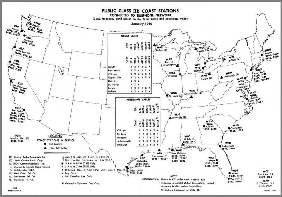
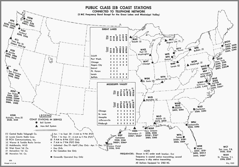
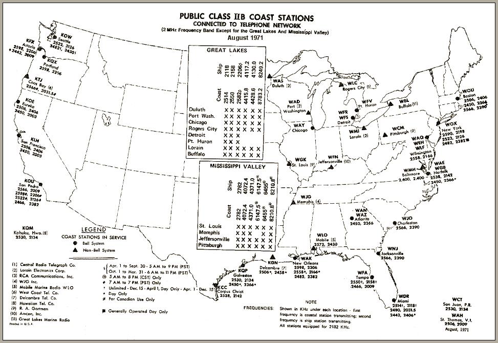
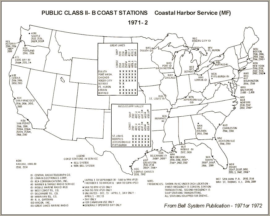
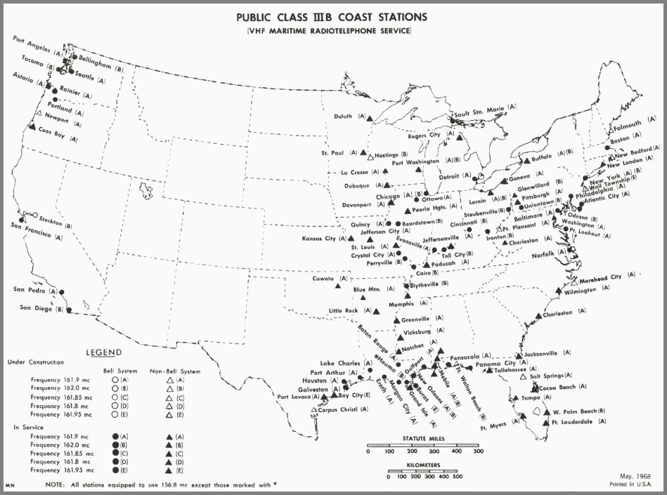
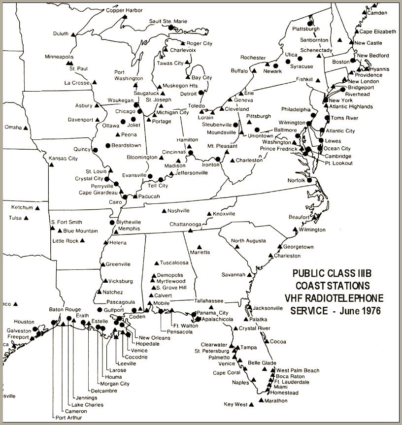
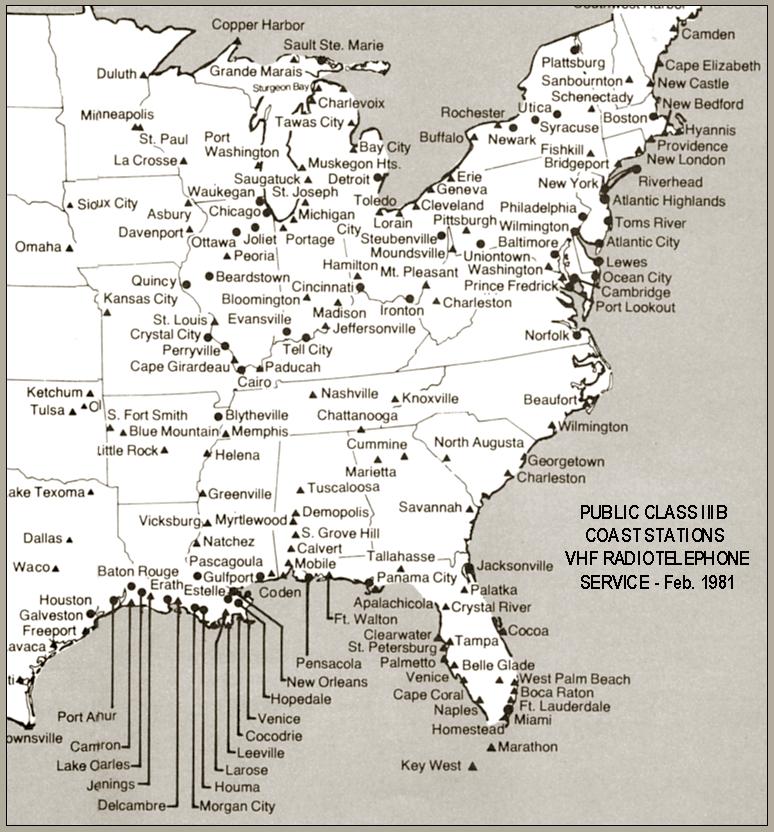
Cities with Stations: The little Marine Radiotelephone Service pamphlets produced by AT&T contained maps that showed the city locations of the stations. Taken together these maps show some of the changes in the operational status of the stations serving the US including those serving the lakes and rivers. There are both MF/HF and VHF maps covering the period from the late 1950s to the early 1980s as follows:
MF/HF: 1947-8 ~ --- Late 1950's --- 1966 --- 1968 --- 1971 --- 1971-2 --- * 1974 # --- 1976 # --- 1981
VHF-FM: 1968 --- 1974 --- 1976 --- 1981
Known errors in these AT&T MF/HF maps are:
WAY - Chicago should be included on all of the Mississippi Valley frequency lists.
~ The Pittsburgh station shown on this map was licensed but not on the air.
* The ownership for WBL on this map should be (11) rather than (4).
# WAY - Chicago should be included on this map as a Bell System station.
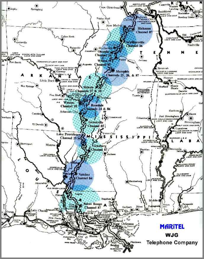
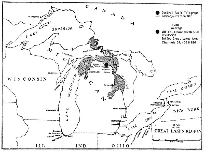
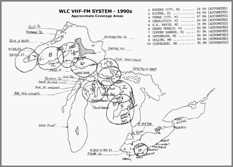
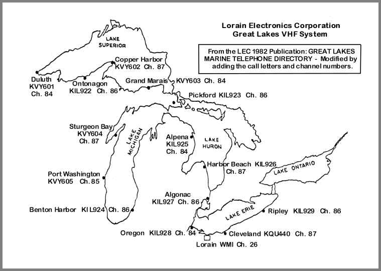
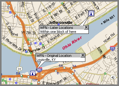
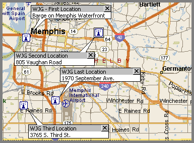
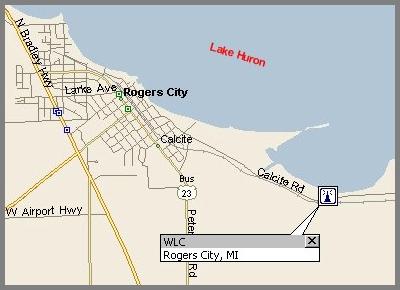
VHF-FM Networks: Several of the stations (or successors) operated multi-station remotely-controlled VHF-FM networks. Here are maps of some of those networks:
WFN/Watercom --- WGK --- WJG --- WLC Early --- WLC Late --- WMI --- WLO
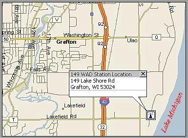
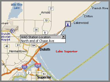
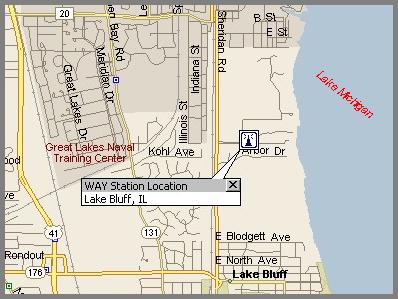
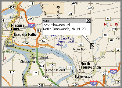
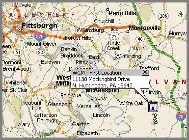
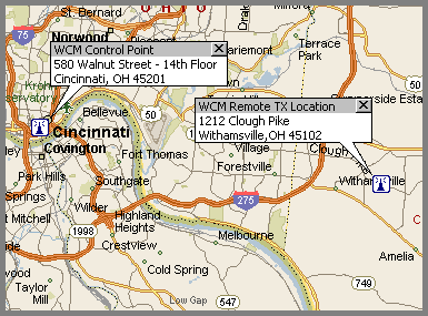
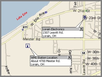
Station Locations: The exact locations for the stations with links below are known, and the MS Streets and Trips program has been used to generate maps showing the station location(s) in more detail:
WAD --- WAS --- WAY --- WBL --- WCM-P --- WCM-C --- WFN --- WGK --- WJG --- WLC --- WMI
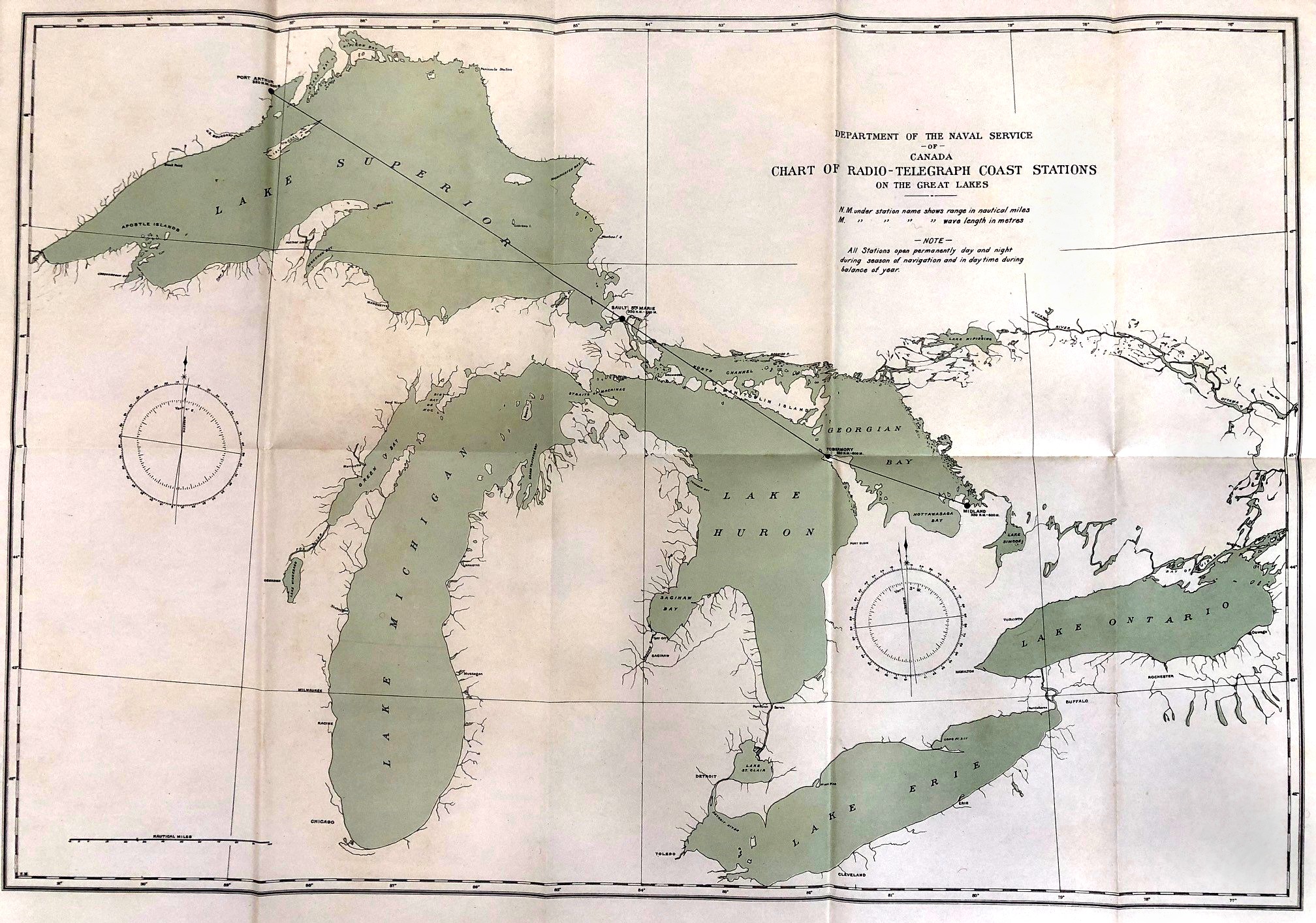
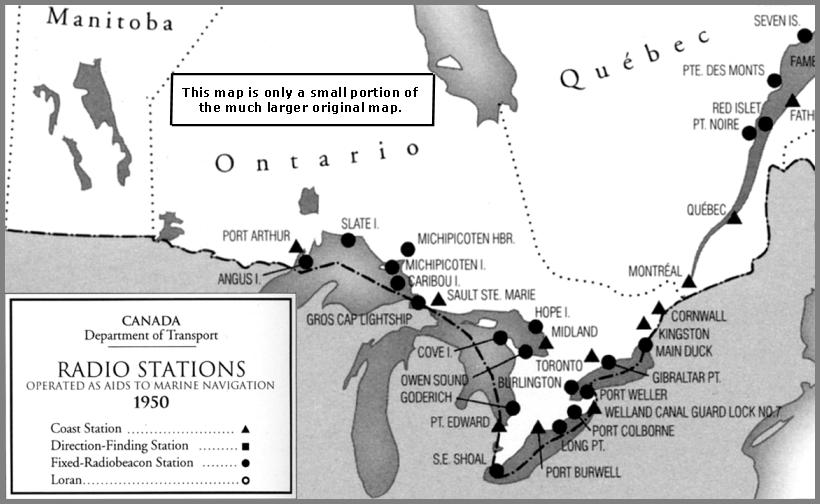
Canadian Stations: Here's a 1912 Map of Great Lakes Canadian Radio-Telegraph Stations and a 1950 Map of the Canadian Great Lakes Stations. This (Off-Site) Map shows the 2023 Canadian MTCS VHF-FM station locations.
This Great Lakes Radiobeacon Maps page has 1947, 1965 and 1985 versions of the Coast Guard's maps. These are too large for cell phones.
Back to the Overview
page