Great Lakes Radiobeacon Maps
There are three maps on this page: 1947, 1965 and 1985, but they are too large for cellphones.
Here, courtesy
of Joe Papworth, K8MP, is a PDF of the 1947 Great Lakes Beacon Map which can be enlarged for detailed viewing.
![Image of a Map of 1947 Great Lakes redio beacons]()
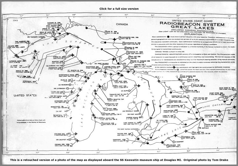
Click on this 1965 map for a detailed version. From a museum ship display photographed by Tom Drake W4IWH
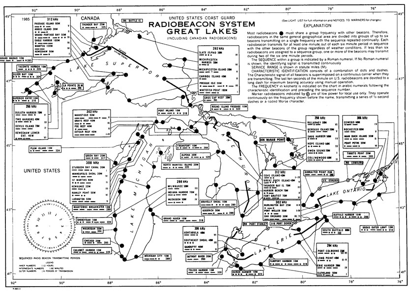
Click on this 1985 map for a detailed version.